VicSouth
Desert Spring
Star Party
at the
Little Desert Nature Lodge
Weather at VicSouth
VicSouth proceeds regardless of weather. We've never failed to have at least one clear night during the event, and generally we've done much better than that. Remember that a weather forecast is just that - a forecast - and we've had some gloomy forecasts turn out to be totally wrong. We've also had some lovely forecasts turn out to be wrong too, which is why we always have plenty of movies on hand for a cloudy night!
Weather information relevant to VicSouth includes:
- The Bureau of Meteorology's Nhill weather forecast.
- The Bureau's Mt Gambier weather radar and Rainbow weather radar can both see rain falling in Nhill, but not the clouds they're coming from. For clouds you need the satellite view. Infrared and Infrared+Zehr images work 24 hours a day. Unfortunately the BOM's infrared images have trouble distinguishing low-altitude night time cloud from the ground itself.
- And of course, two weather websites designed specifically for astronomers, Skippy Sky and Cloud Free Night.
NOTE -- no cloud forecasting model can RELIABLY predict VicSouth cloud more than a day or so in advance.
We also have some data from the official weather station in Nhill, 16km from the VicSouth venue:
- Over 100 years of observations (until 2009) from the original Nhill weather station are summarised in Nhill's climate statistics (comma-separated file). The years since 2003 are summarised in Nhill aerodrome's climate statistics (comma-separated file).
- Daily observations around the time of VicSouth 2006 (PDF file).
- Daily observations around the time of VicSouth 2007 (PDF file).
- Daily observations around the time of VicSouth 2008 (Oct) and VicSouth 2008 (Nov) (PDF files).
- Daily observations around the time of VicSouth 2009 (PDF file).
- Daily observations around the time of VicSouth 2010 (Oct) and VicSouth 2010 (Nov) (PDF files).
- Daily observations around the time of VicSouth 2011 (Oct) and VicSouth 2011 (Nov) (PDF files).
- Daily observations around the time of VicSouth 2012 (PDF file).
- Daily observations around the time of VicSouth 2017 (PDF file).
- Daily observations around the time of VicSouth 2018 (PDF file).
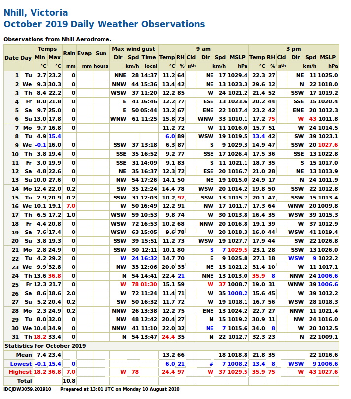
- Daily observations around the time of VicSouth 2019 (screenshot image).
- Daily observations around the scheduled time of the cancelled VicSouth 2020 (PDF file).
- Daily observations around the scheduled times of the cancelled VicSouth 2021 (Oct) and VicSouth 2021 (Nov) (PDF files).
- Daily observations around the scheduled times of the cancelled VicSouth 2022 (Oct) and VicSouth 2022 (Nov) (PDF files).
Daytime satellite images
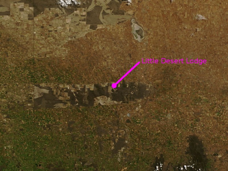
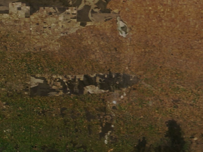
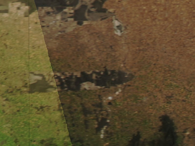
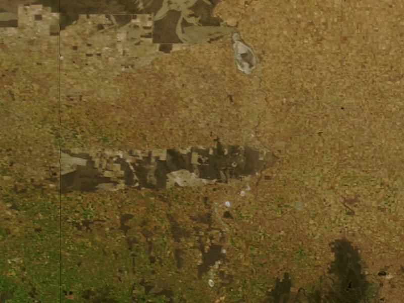
Below are portions of MODIS true colour images, centred on the Little Desert Lodge and showing daytime cloud cover. Resolution of these portions is 250 metres per pixel, ie: each image covers a 200x150km rectangle.The thin vertical black line is the border between SA and Vic (added by the MODIS image processing). The horizontal bullet-shaped patch is the Little Desert National Park. The dark patch near the bottom right corner is the Grampians National Park. The larger blotchy light/dark area in the upper left are the adjoining Big Desert (in Vic) and Ngarkat (in SA) National Parks.
The MODIS instrument flies aboard two satellites, Terra and Aqua, which are in sun-synchronous and nearly polar orbits. During the daytime half of their orbits each satellite images a continuous swath of the Earth passing below it. Terra produces a mid-morning (local time) image, Aqua produces an early afternoon image.
The VicSouth 2007 images below show that daytime satellite images can be deceiving. Thursday night to Sunday night were all totally clear, but compare the cloud covers during the afternoons before and the mornings after.
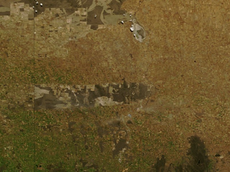
 VicSouth 2007 Thursday afternoon Aqua image. Thursday night was the first of four consecutive clear nights.
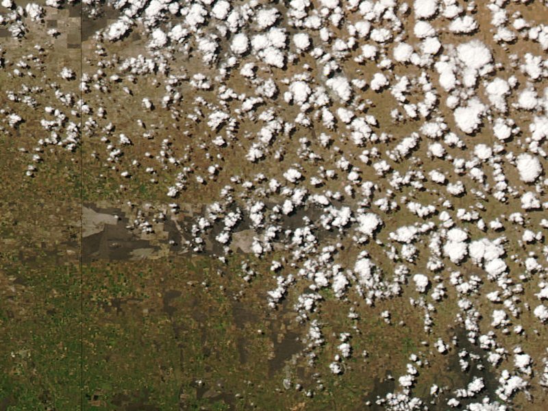
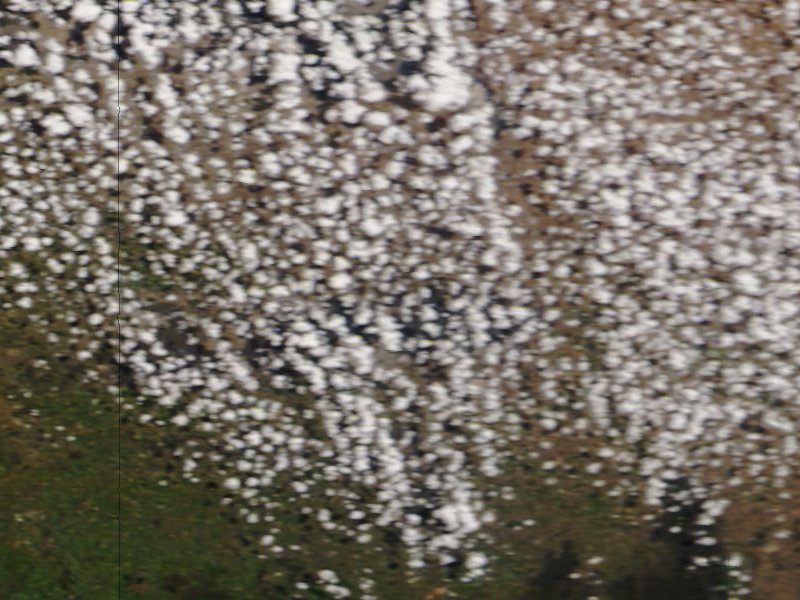 VicSouth 2007 Friday morning Terra image. After several hours of sunlight, the warm humid air rising from ground level has produced numerous puffy white cumulus clouds.
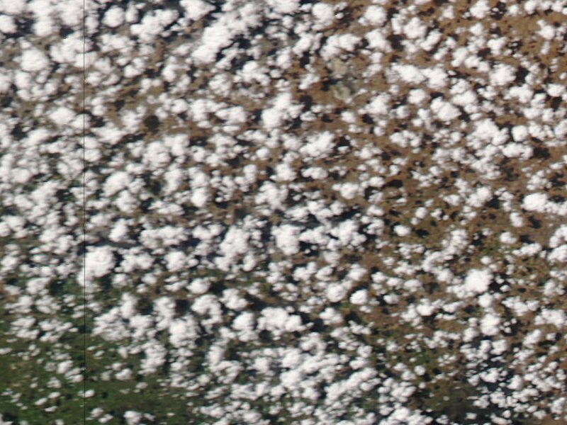 VicSouth 2007 Friday afternoon Aqua image. The cumulus clouds are beginning to consolidate but there's not enough moisture to generate huge clouds. Later as the ground (and air) cooled with the approaching sunset, the convection sustaining these clouds failed and the clouds evaporated. The night was clear but you might not have expected that, seeing these afternoon clouds!
 VicSouth 2007 Saturday morning Terra image. Less humidity today so it's taking much longer to generate clouds.
 VicSouth 2007 Saturday afternoon Aqua image. A single cloud interrupted Saturday night's viewing, for about five minutes....
 VicSouth 2007 Sunday morning Terra image
 VicSouth 2007 Sunday afternoon Aqua image. This one was assembled from adjacent image swathes by the MODIS website, so there's a "join" through this image. Resolution is also poorer because the swath edges are much further from the satellite than the swath centre.
 VicSouth 2007 Monday morning Terra image
...